One of my favorite topics! I love reading maps and learning about different parts of the world. Chile is a fascinating country that includes many interesting geological features. From north to south Chile is 2,700 miles or 4,300 km long. That stretches from New York to San Francisco and it never gets more than 150 miles or 240 km wide because it is bordered by the Pacific Ocean to the west and the Andes Mountains and Argentina to the east. It also includes some Pacific Islands like Easter Island and Juan Fernandez Island and part of Antarctica!


This map shows the political regions of Chile, Regions 15, 1, and 2 are the Far North, Norte Grande, of the Atacama Desert. The northern part of Chile is the Atacama Desert- one of the driest deserts in the world. Some locations here have never had any recorded history of rain! They have a desert climate, coastal cliffs, high coast range, intermediate depression and Andes with plateaus with salt flats, copper and saltpeter deposits in the interior. Major cities include Arica, Iquique, and Antofogasta with San Pedro de Atacama being a popular tourist city in the high desert plateau. Geographical wonders of this region include the salt flats as well as the Tatio Geyser and Valle de la Luna seen below courtesy of Wikipedia.

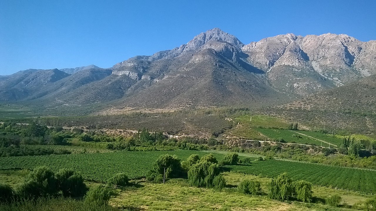
Regions 3 & 4 are called Chico Norte or the Near North and include Coquimbo and La Serena. Geographical features include a semi-arid climate with a coast range and Andes merging with transversal east-west valleys instead of intermediate depression. No volcanoes and periodic flowering in parts of the desert.
Below is a picture of one of these transverse valleys with a river makes them sheltered and productive agricultural lands. Picture courtesy of Wikipedia.
The next region is 5 & 13 which are the metropolitan regions of Valparaiso on the coast and Santiago. These regions are charactreized by a mediterranean climate and matorral vegetation of scrubland and trees adapted to dry summers and wet winters. The Andes are massive and high here with the coast range and Andes separating to the south, fertile intermediate depression with very prolific agriculture especially wine grapes.
The picture below courtesy is Wikipedia of Santiago with the Andes to its east.

The Central Zone also includes the regions of 6 (O’Higgins), 7 (Maule), & 8 (Bio Bio). Major cities include Rancagua, Talca, and Concepcion. Region 6 is home to most of Chile’s fruit orchards – apples, pears, grapes, plums, and kiwis. and is also known for copper mining. Region 7 is the wine growing region of Chile with the famous Curico Valley. The 8th region, Bio Bio, has 44 % of Chile’s forest plantations.

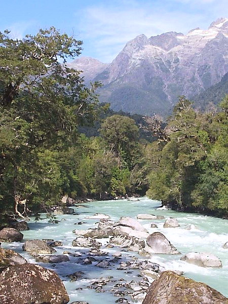
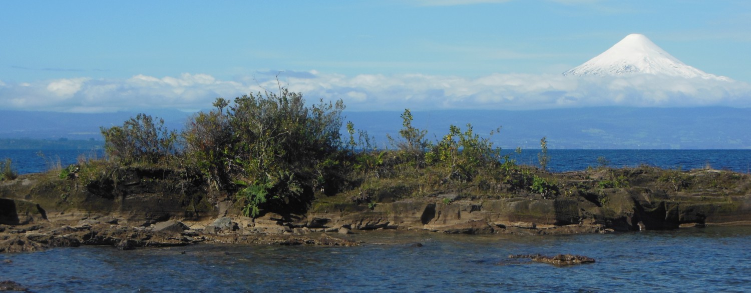
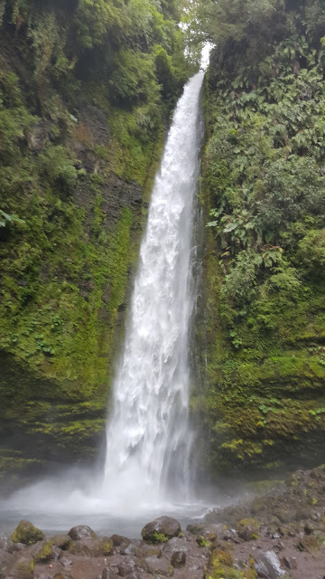
The Zona Sur includes Region 9 Araucania, Region 14 Los Rios, and Region 10 Los Lagos. This zone has a temperate oceanic climate meaning mild year round with dry summers and wet winters and Valdivian rain forest vegetation. The climate is moderated by the Humboldt current which is a large ocean current bringing cool water and air up from the south and Antarctica heading north up the coast of Chile. This current like it’s counterpart in the Atlantic, the Gulf Stream, moderates the climate but instead of warm water we have cool ocean water which is rich in sea life. The coast range and Andes are low with the intermediate depression near sea level and continuing out into the ocean south of Puerto Montt. The lakes are of glacial origin with intensive volcanic and geothermal activity.
The Zona Austral includes the southern part of Los Lagos Region 10 and Region 11 Aisen and region 12 Magallanes. This is the region known as Patagonia. The climate is subpolar oceanic with Magellanic vegetation which is broadleaf and mixed of the southern most forests. The coast range consists of islands, intermediate depression absent or under sea level and fjords and ice fields, glaciers, in the Andes.

All pictures courtesy of Wikipedia.
Now you may be wondering why the regions are not in descending order!
Quote from Wikipedia
Each region is given a Roman numeral, followed by a name (e.g. IV Región de Coquimbo, read as “fourth region of Coquimbo” in Spanish). When the regional structure was created, Roman numerals were assigned in ascending order from north to south, with the northernmost region designated as I (first) and the southernmost region as XII (twelfth). The Santiago Metropolitan Region, located in the center of the country and home to the country’s capital Santiago, was excluded from this naming scheme and given instead the initials RM, standing for Región Metropolitana (“Metropolitan Region” in Spanish). With the creation of regions XIV in the south and XV in the north (XIII is not used) in 2007, the north-south Roman numeral order was broken.


 Pudus are mostly solitary and only come together during mating. Fawns are born in November through January which is the austral summer months singly or in pairs. Herbivorous, they live in the bamboo thickets of the Valdivian rainforest. Predators include magellanic horned owls, the fox, and pumas.
.jpg)